
Dallas weather: Flood Watch in effect as cooler weather and heavy rain move into the region
AUSTIN, Texas - The September heat wave continues for two more days and then all the pieces to the rain puzzle come together for the second half of the week. [Fox 7 Austin]
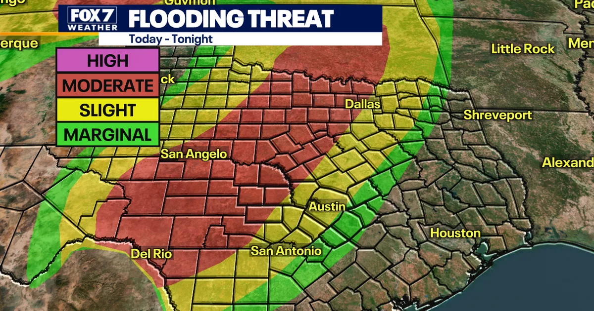
A significant weather system is expected to drench much of Texas this week, bringing multiple rounds of heavy rainfall and widespread flood risks across central and north portions of the state through Friday.
The setup involves a slow-moving frontal boundary colliding with abundant tropical moisture from the Gulf of Mexico and Pacific Ocean, creating favorable conditions for extended wet weather. An upper-level atmospheric system will provide additional lift to strengthen storm development throughout the event, with the front potentially stalling over the region—a scenario that could intensify localized rainfall through a phenomenon known as training, where successive storms move over the same areas.
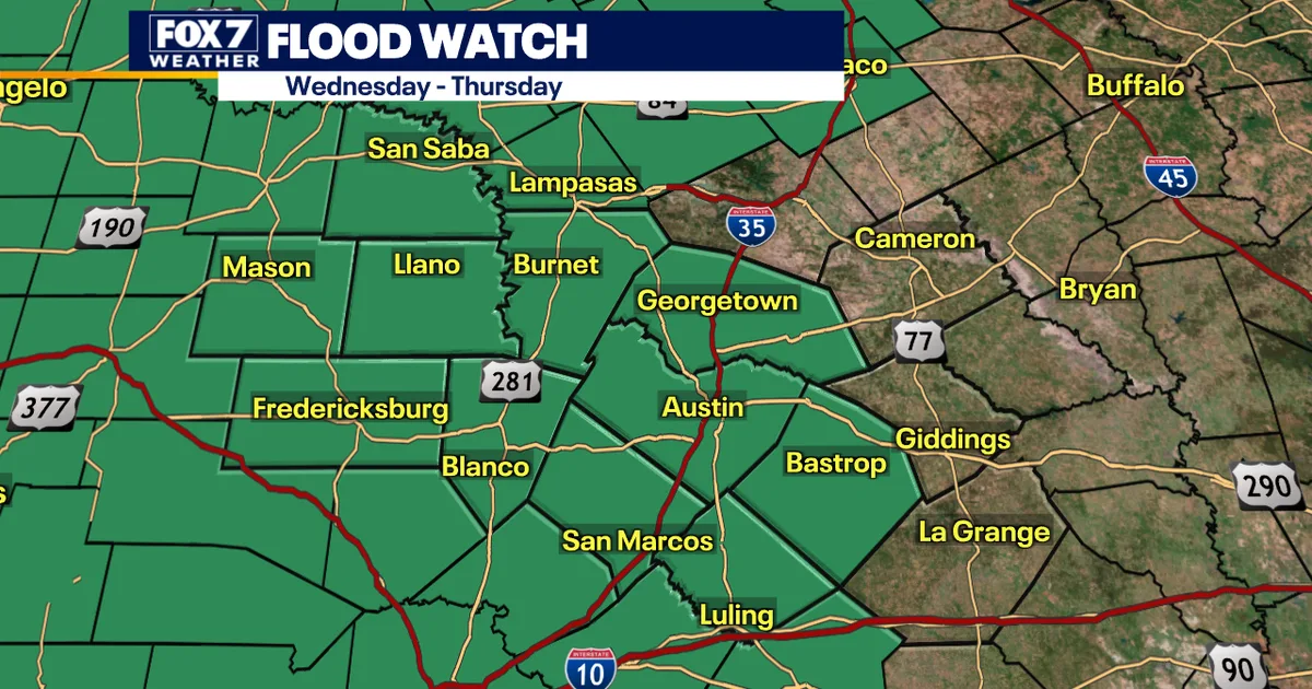
Central Texas residents face a flood watch extending from late Wednesday through at least Thursday evening, with the highest threat occurring Thursday. Most of the region expects 2 to 4 inches of rainfall, though the Hill Country could see substantially more. Isolated locations may receive between 4 and 6 inches, with the greatest accumulations likely where the frontal boundary remains stationary. Moderate to high flood risks threaten streets, low-lying areas, creek and river systems throughout the region.
In the Dallas-Fort Worth area, scattered storms are anticipated to develop Wednesday afternoon, particularly west of Interstate 35W, with a flood watch remaining in effect through Friday morning. North Texas can expect widespread rainfall of 2 to 4 inches over the next day and a half, with some isolated areas potentially reaching 5 to 6 inches. The exceptionally dry ground conditions in the region will contribute to rapid surface runoff and increased flooding potential as storms potentially train over similar locations.
Wednesday will remain hot and humid across both regions, with temperatures reaching the low 90s and winds gusting between 25 and 30 mph in the Dallas area. A marginal severe weather risk exists west of the metroplex, with primary threats limited to gusty winds near 60 mph and small hail, while tornado chances remain minimal.
Relief arrives Friday as a strong cold front pushes through, dramatically improving conditions. Highs will drop from near 92 degrees to the upper 70s and lower 80s, with overnight lows settling into the comfortable low to mid-60s. Scattered showers may linger into Saturday before conditions dry out by Sunday.
Coverage from 3 newsrooms
Austin weather: Flood Watch as downpours and storms expected
A flood watch has been issued for the Austin area as a stalled front and upper low system bring multiple rounds of heavy rain and storms exp…
Dallas weather: Flood Watch in effect as cooler weather and heavy rain move into the region
A Flood Watch has been issued for North Texas as heavy rain and cooler weather move into the region ahead of a weekend cold front.
Austin weather: Flood Watch issued as heavy rain, strong storms
A Flood Watch has been issued for the Austin area as heavy rain and strong storms are expected over the next few days due to tropical moistu…