
Flood Watch takes effect tonight as Kerr County braces for heavy rain

The National Weather Service has issued a Flood Watch for the Atascosa County area as several days of showers and thunderstorms could bring heavy rainfall and the potential for flooding. [Pleasanton Express]
# Article Body
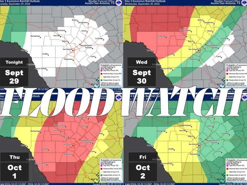
A significant weather threat will grip South Central Texas over the next 48 hours as moisture from a strong Pacific hurricane combines with an approaching cold front to produce dangerous rainfall and potential severe weather. The National Weather Service extended protective watches across a 28-county region, including Kerr, Atascosa, Bandera, Gillespie, Kendall, Real and Edwards counties, with the alert period running from 7 p.m. Wednesday through 7 p.m. Friday.
Meteorologists have tracked this system for more than a week, with forecasters initially uncertain whether heavy precipitation would arrive midweek or wait until Friday. The decisive factor became moisture from Hurricane Polo, which reached Category 2 strength while crossing Mexico's Baja California peninsula early this week before moving into Sonora. The National Hurricane Center indicated the storm's remnant moisture could indirectly trigger flooding across the Southwest. On Tuesday, Arizona already experienced flash flooding and water rescues related to Polo's effects.
By Monday, forecasters deemed the heavy rain and flash flood threat for Wednesday evening into Thursday "very reasonable." The anticipated rainfall will be substantial. Widespread precipitation totals between 1 and 4 inches are expected across the region, with isolated areas potentially receiving as much as 8 inches. The heaviest concentrations could produce flash flooding in low-lying areas. Additionally, individual storms could become severe, producing damaging winds and large hail, with tornado formation possible during the most active periods.
Atmospheric conditions favor rapid rainfall development. A Pacific cold front advancing into the Hill Country will encounter unusually moist air, with weather balloon readings Wednesday morning in Del Rio and Fort Worth exceeding 90 percent of historical measurements for this time of year. This combination of ingredients allows thunderstorms to produce heavy downpours quickly, increasing flood risks.
Texas state officials mobilized resources ahead of the storm's arrival. The state stationed two emergency medical task forces in Kerrville, each comprising 22 personnel and 11 pieces of equipment. A Texas Military Department ground transportation unit with 10 soldiers and five high-profile vehicles capable of reaching stranded motorists was also positioned there. The State Operations Center in Austin activated continuous operations Tuesday morning. Gov. Greg Abbott previously announced that more than 1,900 state resources had been allocated for the weather event.
The forecast extended beyond the primary watch period, with precipitation chances remaining in the forecast through the weekend. Friday conditions should improve slightly, though scattered showers and thunderstorms remained possible. Saturday carried a 70 percent likelihood of showers and possible thunderstorms, with additional rain chances persisting through Monday in the region.
Coverage from 2 newsrooms
Flood Watch issued as heavy rain approaches Atascosa County
The National Weather Service has issued a Flood Watch for Atascosa County from Wednesday evening through Friday evening due to expected heav…
Flood Watch takes effect tonight as Kerr County braces for heavy rain
A Flood Watch for Kerr County and South Central Texas takes effect tonight through Friday as forecasters expect 1 to 4 inches of rain with i…